Distance : 1 km to lake, additional 1.7 km to viewpoint Elevation : 60 m to lake, 215 m to viewpoint Difficuty : Easy to moderate to lake, moderate to viewoint This is an easy access trail that winds through stunted sub-alpine forest to a crystal clear, emerald jewel alpine lake. You may want … [Read more...]
Schoolhouse Mountain Falls
Distance : East Falls - 1.5 km, West Falls - 2 km Elevation Gain : East 300 m, West 330 m Difficuty : East - Moderate to difficult, West - moderate These trails offer a moderately strenous uphill effort to the tall, cascading falls. The first part of the trail goes through a unique and … [Read more...]
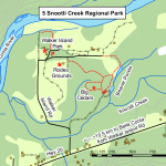
Snootli Creek Regional Park
Distance : Various lengths from 200 m to 2 km Elevation change : 5 m Difficuty : Easy This trail system provides an interesting walk as it offers a variety of natural sights and historic features. The first trail branches off to the left to an ancient grove of culturally modified cedar … [Read more...]
Hagensborg Loop Trail
Distance : About 6.5 km Elevation change : about 200m Difficuty : Moderate This trail begins by following the Schoolhouse Mountain falls trail to the west falls. At the point where the west falls trail heads up hill the loop trail veers westward slighty downhil to a ford crossing of the creek. … [Read more...]
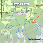
Snooka Trail System
East Trail Distance : 5.4 km Elevation change : 50 m This trail undulates through second growth forest and was developed for mountain biking but provides a pleasant shaded walk on a hot day. The East loop takes off from the south loop and heads east on to private land and ends at Hwy 20. The … [Read more...]
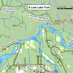
Lost Lake Trail
Distance : 1km one way Elevation : 180m Difficulty : Moderate This trail winds uphill through old growth forest to a small lake and great view spots looking over the valley and mountains to the south. The trail begins in a second growth forest but quickly climbs up a rocky slope into … [Read more...]
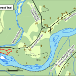
Saloompt Forest Trail
Distance : Various from 300m to 1km Elevation : Flat Difficulty : Easy This is an interpretive trail with unique forest features and valley bottom ecosystems. There are three different trails within this partk. Each has its own special features. There is an ancient forest stand … [Read more...]
BC Hydro Clayton Falls Recreation Site
Distance : 200m to falls, 300m loop in the park Elevation change : 4 m Difficulty : Easy With a great shoreline picnic site and a viewing platform of the falls cascading through a canyon of cliffs scoured smooth by water and glacial action, the BC Hydro Clayton Falls Recreaton Site is one of … [Read more...]
Bear and Cougar Awareness
Bella Coola is home to grizzlies, black bears and cougars You may come across them on any trail, at any time, so it is important to take precautions and follow some basic practises to reduce risk of close encounters : Always let someone know where you are going and when you plan to … [Read more...]
Stewardship
Management of the Bella Coola Community Forest is done in accordance with a set of stewardship and operating principles: Stewardship Principles Forest resources are managed in a manner that assures environmental sustainability. Timber resources are managed on a sustainable basis in accordance … [Read more...]

