Distance : 1km one way
Elevation : 180m
Difficulty : Moderate
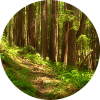
This trail winds uphill through old growth forest to a small lake and great view spots looking over the valley and mountains to the south.

The trail begins in a second growth forest but quickly climbs up a rocky slope into a peaceful, moss carpeted old growth Douglas-fir forest. Lost Lake is quite small, but the views from the trail end are rewarding. The two lookouts here offer a great picture of the glaciated u-shaped valleys of the lower Bella Coola and Nusatsum Rivers.
The first lookout is to the right of the lake and the second one is beyond the lake on a trail that leads slightly downhill. At the first lookout you can easily identify Hagnesborg and the airport. Look a little closer and you may even see the Augsburg Chuirch. A the second lookout, the view to the south is the Nusatsum valley with its regenerated logging areas and the road to Odegaard Falls.

In the foreground, Nusatsum Mountain is on the left and Schoolhouse Mountain on the right. Looking out over the Bella Coola River to the east, you can see the edge of Tweedsmuir Provincial Park beyond the small community of Firvale.
How to get there
Access from Highway 20 is the same as for the Saloompt Forest Trail, except at the ‘Y’ junction on Saloompt Road, keep right. This road turns to gravel at 1.3km, the start of the Saloompt Forest Service Road.
At the next main intersection (another 1km) continue right, up the hill for 0.5km, then right again at the top of the hill. Follow this road about 3km to the parking area and the trailhead near the base of Saloompt Peak.