Distance : 1 km to lake, additional 1.7 km to viewpoint
Elevation : 60 m to lake, 215 m to viewpoint
Difficuty : Easy to moderate to lake, moderate to viewoint
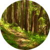
This is an easy access trail that winds through stunted sub-alpine forest to a crystal clear, emerald jewel alpine lake. You may want to go for a quick swim, athough the neighbouring pond east of the lake is warmer. Wildfowers are abundant and provide colourful blooms in July and August. Beyond the lake the trail is not as distinct, but still easy to follow. Once on the rocky part of the ridge pick your own way to the highest point. The viewpoint above the lake provides awesome views of the coast mountain peaks rimming North and South Bentinck Arms, Burke channel and the upper Clayton Falls Valley.
How to get there
To access the trail, drive west beyond the government wharf onto the North Bentinck Forest Service Road. At 1.5 km, take the Clayton Falls Forest Road to the left. Athough there are a number of steep sections along this road, the steepest is the first 200m. Drive slow and steady to minimize road disturbance on the hills. This road has been deactivated with numerous water bars or cross ditches for water maintenance. A high clearance 4×4 vehicle is recommended. The trailhead is at about 17 km from the start of Clayton Falls forest Road. Park adjacent to the large boulder, just below the last switchback. The trailhead is just ahead on the opposite side of the swithcback. Before leaving, make sure to continue 200 m up the road beynd the M Gurr Lake Trailhead to the summit pass – a great place to take in the grand panoramic view. Even if you choose not to hike, the drive alone is spectacular!