• Home
  • About Community Forests
    • What is Community Forestry?
    • Bella Coola Community Forest Agreement
  • Who We Are
    • Bella Coola Community Forest Ltd.
    • Bella Coola Resource Society
    • Organizational Structure
    • Advisory Committee
    • Our Partners
    • Local Contracting and Consulting Resources
  • Maps
  • Gallery
    • At Work
    • Scenery
    • Special Events
    • Wildlife
    • Markets & Products
  • Links
  • Contact

Bella Coola Community Forest

Sustainable Local Forestland Management

  • Outdoor Activities
    • Hiking Trails
    • Bear and Cougar Awareness
    • Forest Road Access Status
  • What’s New
  • Publications
  • Forest Resources
    • Lands
    • Sustainability
    • Fish and Wildlife
    • Reforestation
    • Culture & Heritage
    • Non-Timber Forest Products
  • Community
    • Support
    • Benefits
    • Our Partners
  • Operations
    • Planning
    • Logging
    • Reforestation
    • Active Areas
    • Firewood
    • Safety
  • Products
    • Timber
    • Markets & Finished Products
    • Local Manufacturing

Saloompt Forest Trail

Distance : Various from 300m to 1km
Elevation : Flat
Difficulty : Easy

This is an interpretive trail with unique forest features and valley bottom ecosystems. There are three different trails within this partk. Each has its own special features.

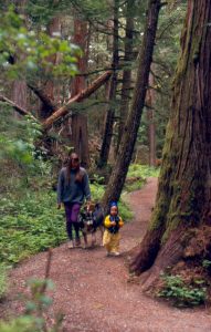
There is an ancient forest stand with massive Douglas-Fir, cedar and spruce intermingled with hamlock, cottonwood, alder and maple. There are eagle nests, bear scratch trees, fast-growing second growth forests, an old homestead site, springboard logging stumps, and lots of lush temperate rainforest undergrowth.

A side channel of the Bella Coola River flows along the south side of the park. Once back out on the road, walk to the bridge over the Saloompt River. This is a great place to see salmon spawning during August and September.

How to get there

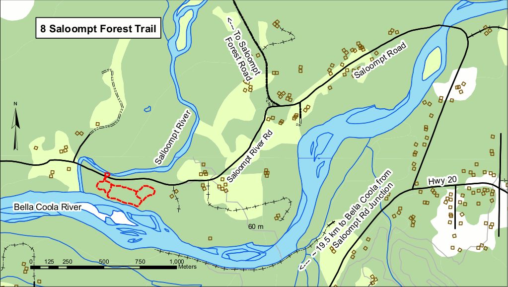
Turn north on Saloompt Road, 19.5km east of Bella Coola on Highway 20. Follow this road, which crosses the Bella Coola River, for 2.6km. Veer left, at the ‘Y’, down the Saloompt River Road. The trail parking area is 1.4km from the ‘Y’.

Caution : This area if frequented by bears during spawning season. Use with caution.

Snootli Creek Regional Park PDF Download Map PDF

Filed Under: Articles

Bella Coola Community Forest Ltd.

Photo Galleries

Gallery

Stewardship

Stewardship

Outdoor Recreation

Outdoor Recreation

Fish and Wildlife

Fish and Wildlife

Copyright © 2025 Bella Coola Community Forest Ltd ยท Log in