• Home
  • About Community Forests
    • What is Community Forestry?
    • Bella Coola Community Forest Agreement
  • Who We Are
    • Bella Coola Community Forest Ltd.
    • Bella Coola Resource Society
    • Organizational Structure
    • Advisory Committee
    • Our Partners
    • Local Contracting and Consulting Resources
  • Maps
  • Gallery
    • At Work
    • Scenery
    • Special Events
    • Wildlife
    • Markets & Products
  • Links
  • Contact

Bella Coola Community Forest

Sustainable Local Forestland Management

  • Outdoor Activities
    • Hiking Trails
    • Bear and Cougar Awareness
    • Forest Road Access Status
  • What’s New
  • Publications
  • Forest Resources
    • Lands
    • Sustainability
    • Fish and Wildlife
    • Reforestation
    • Culture & Heritage
    • Non-Timber Forest Products
  • Community
    • Support
    • Benefits
    • Our Partners
  • Operations
    • Planning
    • Logging
    • Reforestation
    • Active Areas
    • Firewood
    • Safety
  • Products
    • Timber
    • Markets & Finished Products
    • Local Manufacturing

Snootli Creek Regional Park

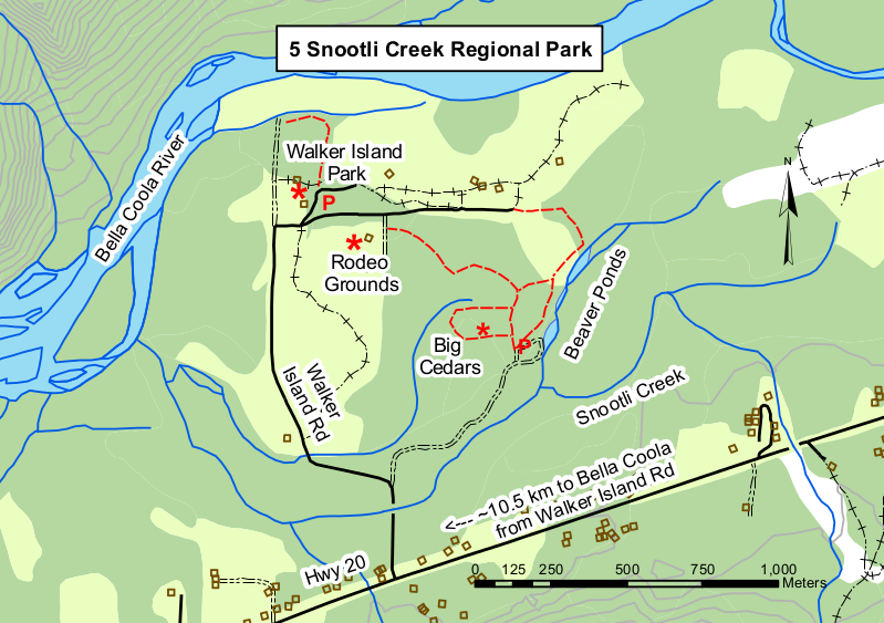
Distance : Various lengths from 200 m to 2 km
Elevation change : 5 m
Difficuty : Easy

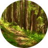
This trail system provides an interesting walk as it offers a variety of natural sights and historic features. The first trail branches off to the left to an ancient grove of culturally modified cedar trees.

snootli-creek-regional-park

This area requires respect not only for the forest but also for the First Nations people that used this area for acquiring bark and lumber from these sacred and special ‘trees of life’. Look for the distinct scars left after planks were cut and split away from the living tree. This grove also features huge cottonwood, Sitka spruce and Douglass maple.

Back on the main trail, carry on past the cottonwod grove through second growth to the rodeo grounds, hike through the cottonwood grove or loop back along the beaver pond to the road and the parking area. A variety of water flow can be seen at the pond and look for beaver gnawing signs on shoreline trees. These trails are for hiking or biking.

How to get there

Turn north onto Walker Park Road, 10.5km east of Bella Coola on Hwy 20. Drive straight on to the gravel road at 30m. Follow this road around the loop to the beaver pond then continue around to the small pullout near the end of the loop. This is the beginning of series of trails. Small signs guide you around the park.

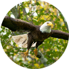
Caution : This area is frequented by bears so be vigilant.

Snootli Creek Regional Park PDF Download Map PDF

Filed Under: Articles

Bella Coola Community Forest Ltd.

Photo Galleries

Gallery

Stewardship

Stewardship

Outdoor Recreation

Outdoor Recreation

Fish and Wildlife

Fish and Wildlife

Copyright © 2025 Bella Coola Community Forest Ltd ยท Log in